Oslofjord ferries: island hopping and Bygdøy on your Ruter ticket
Oslo: Hovedøya and Nakholmen island hopping tour
Duration: 3 hours
- Hovedøya
- Swimming spots
How do the Oslofjord ferries work in Oslo?
Ruter operates harbour ferries to Bygdøy (line 91, seasonal) and the inner Oslofjord islands (lines 82–85). All are covered by a standard zone 1 Ruter ticket or Oslo Pass. Ferries depart from Aker Brygge (Bygdøy line) and Vippetangen pier south of Akershus Fortress (island lines). Island services run daily in summer, less frequently in winter.
Public ferries on the Oslofjord: what most visitors don’t know
Oslo has two systems for getting on the water: expensive private boat tours (which are great for what they are), and the public Ruter ferry network, which takes you to the Bygdøy peninsula and the inner Oslofjord islands for the same NOK 42 / USD 4.50 as a tram ride.
Most visitors who discover this find it to be one of Oslo’s best-value surprises. On a warm summer day, you can be sunbathing on an island beach 15 minutes after leaving Akershus Fortress, for the price of a metro ticket.
This guide covers the two public ferry networks in detail: the seasonal Bygdøy ferry and the island ferry lines.
If you are still working out how the fare system fits together, the Ruter public transport guide explains zones and tickets, and getting around Oslo shows where the ferries sit alongside trams, buses and the metro.
| At a glance | |
|---|---|
| Where | Bygdøy ferry from Aker Brygge; island ferries from Vippetangen |
| Cost | NOK 42 (standard zone 1 ticket); Oslo Pass valid |
| Season | Bygdøy: mid-April–mid-October. Islands: year-round, reduced off-season |
| Best for | Independent day trips without a guided tour price tag |
| Tickets | Buy in the Ruter app before boarding — no sales on board |
Ferry line 91: Bygdøy (seasonal)
Operator: Ruter (contracted to Tide Sjø) Route: Aker Brygge (pier 3) → Dronningen (Bygdøy landing stage) → Bygdøykilen Journey time: 10 minutes to Dronningen (main Bygdøy stop); 15–18 minutes to Bygdøykilen Season: Mid-April to mid-October approximately (check Ruter app for exact 2026 dates) Frequency: Every 20–30 minutes during the day (more frequent in peak summer) Ticket: Standard Ruter zone 1 (NOK 42 / USD 4.50 in app; Oslo Pass valid)
What to do on Bygdøy
Bygdøy is Oslo’s museum peninsula — a wooded promontory on the west side of the Oslofjord inlet. The main museums clustered near the Dronningen ferry stop:
- Norsk Folkemuseum (Norwegian Folk Museum): NOK 220 / USD 24. One of the world’s largest open-air museums, with 160 historic buildings and a medieval stave church.
- Fram Museum: NOK 165 / USD 18. The actual polar ship Fram (used in expeditions to the Arctic and Antarctic). Outstanding.
- Kon-Tiki Museum: NOK 165 / USD 18. Thor Heyerdahl’s balsa-wood raft that sailed from Peru to Polynesia in 1947.
- Norwegian Maritime Museum (Norsk Maritimt Museum): NOK 150 / USD 16.
Each of these has its own write-up if you want to plan your visit in detail: the Norsk Folkemuseum guide, the Fram Museum guide and the Kon-Tiki Museum guide. The wider Bygdøy destination page puts the whole peninsula in context, and Viking-era history seekers should read the Viking Ship Museum status update before building a day around it.
Further along Bygdøy: Bygdøy bathing beaches (Huk and Paradisbukta) are 15–20 minutes walk from the ferry stop and free to use.
Practical tip: The ferry only runs April–October. In winter and shoulder seasons, take bus 30 from Nationaltheatret (last stop before Nationaltheatret T-bane station) — it runs year-round and stops at each museum in sequence. Journey time is 15–20 minutes.
Island ferry lines (82–85): the inner Oslofjord islands
Operator: Ruter Route: Vippetangen pier → Hovedøya → Gressholmen → Nakholmen → Bleikøya → Langøyene Journey times: Hovedøya ~5 min; Gressholmen ~15 min; Nakholmen ~20 min; Langøyene ~25 min Season: Daily June–August; reduced schedule September–May Frequency: Every 30–60 minutes in summer; check the Ruter app for current timetable Ticket: Standard Ruter zone 1 (same as any bus or tram)
Getting to Vippetangen pier
Vippetangen is located south of Akershus Fortress. Walk south from Aker Brygge along the Havnepromenaden, past the fortress, and continue 10–15 minutes to the pier. Alternatively, take tram line 12 to Jernbanetorget and walk south 20 minutes, or take bus 60 to Vippetangen.
The pier has a small kiosk open in summer. Bring your own food and water for a day trip — there are no shops on most of the islands.
The islands, one by one
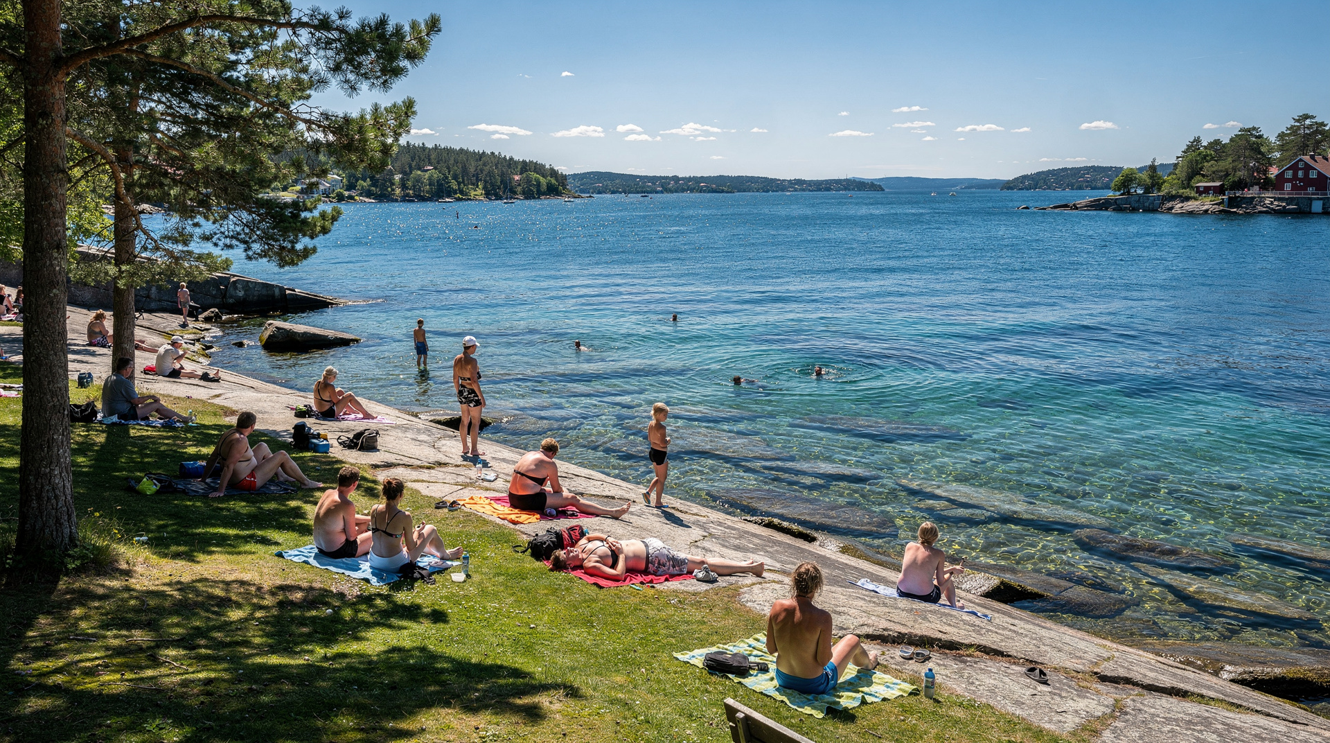
Hovedøya (the main island): The closest island to the city. Ruined 12th-century monastery foundations are the main historical sight. Forest paths, open meadows, and rocky shore. Swimming at the eastern tip on a stony beach. The island has a small café open in summer and basic toilet facilities. Takes about an hour to walk around comfortably. Popular with families and picnickers.
Gressholmen: Smaller and quieter than Hovedøya. An old flying boat harbour (used in the 1920s–30s) gives it an unusual character. Some of the original harbour structures remain. The beaches are small and rocky. Bird life is excellent — eider ducks and various shorebirds. Good for birdwatchers and those wanting a quieter experience.
Nakholmen and Bleikøya: Smaller, more private islands with a mix of permanent summer cottages (owned by long-term Oslo families) and open shoreline. Not the best islands for large groups.
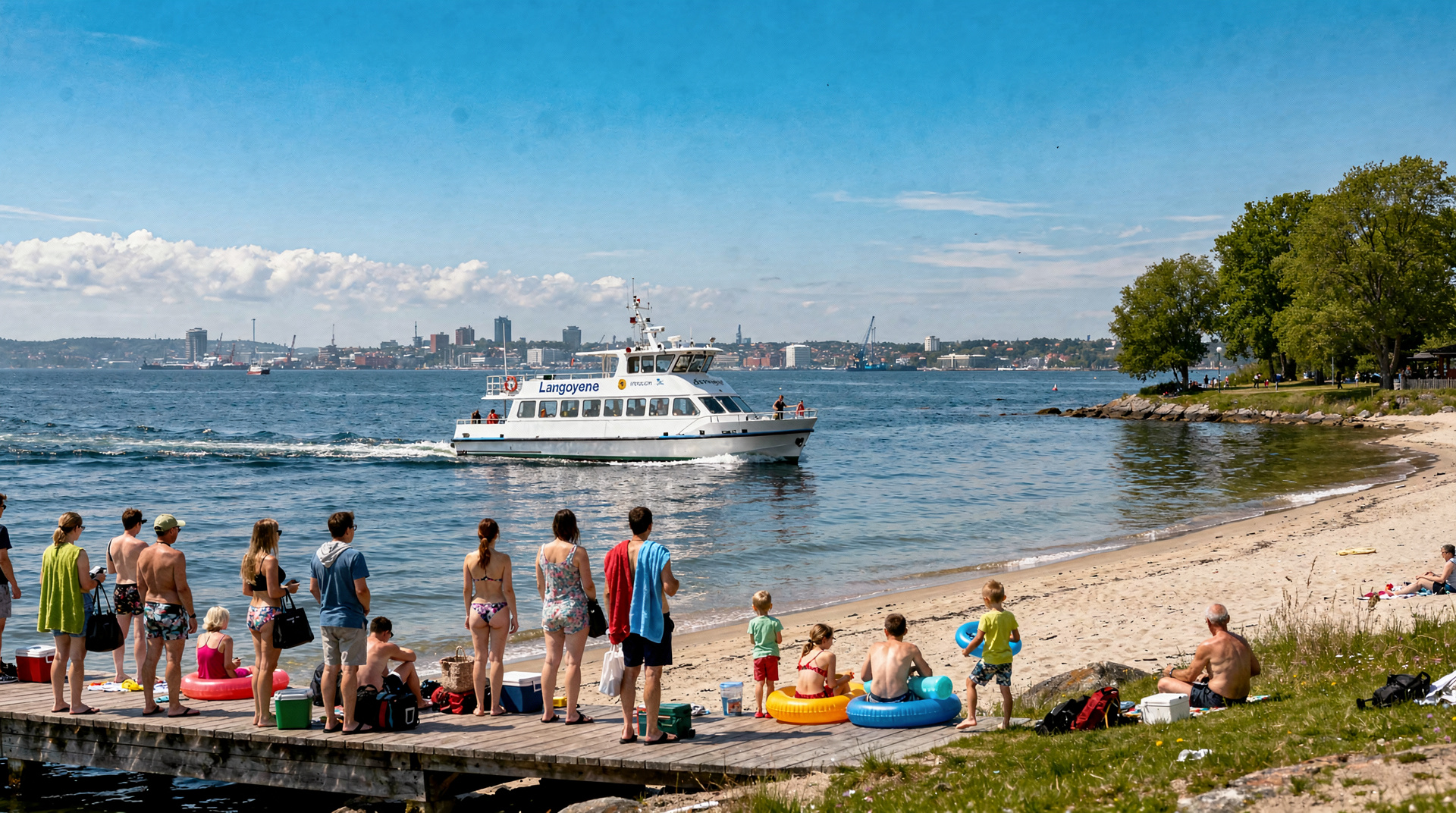
Langøyene: The furthest and the best for beaches. Sandy beaches on the southern shore — by Oslo standards, these are genuinely good swimming beaches. The island has a camping area (one of the few places to camp legally close to Oslo). The western tip has designated nude bathing (mixed). Popular with younger crowds in summer, especially on weekends. Can be busy on hot weekend afternoons.
For a closer look at the two most popular stops, see the Hovedøya island guide and the Oslo beaches guide, which helps you choose where to swim. The Oslo islands destination page gives the overview of the whole archipelago.
Island hopping
You can hop between islands on a single Ruter ticket as long as you remain within the system. Board at Vippetangen, visit Gressholmen, take the next ferry to Nakholmen, then Langøyene — all on one activation, as long as your 90-minute window covers the journey (check this against the timetable). If you’re planning an all-day hop, buy a 24-hour Ruter pass (NOK 155 / USD 17) rather than individual single tickets.
See the full island hopping planning guide at Oslo island hopping.
Private vs public: when to upgrade
The public ferries cover the islands and Bygdøy well. But they’re not designed for sightseeing the fjord itself — they go point to point rather than cruising the water.
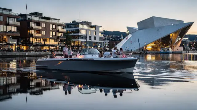
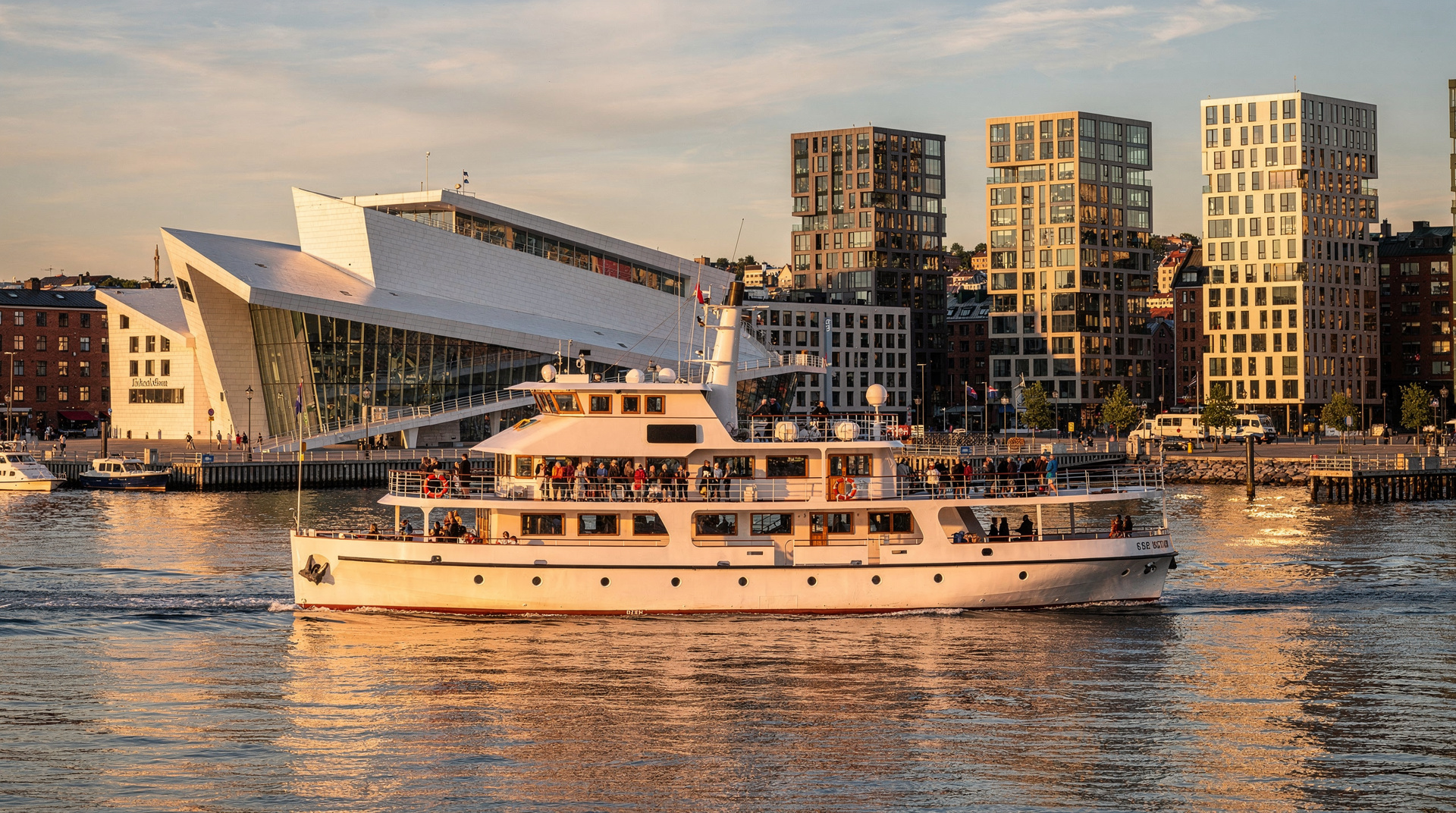
For an Oslofjord sightseeing cruise with commentary, a silent electric boat cruise gives you a guided 2-hour circuit of the fjord, the Opera House, Akershus Fortress, and Bygdøy from the water. This is a paid tour (not a Ruter ferry) — see the tour page for details. The combination of a public ferry day trip to the islands plus one shorter private cruise is how most visitors get the full fjord experience.
For the shrimp buffet cruise format (a local institution — fresh fjord shrimp eaten on the boat), see the best Oslofjord cruises guide, which compares several options including the evening shrimp cruise.
If you cannot decide between formats, the which Oslofjord cruise to pick guide lays out the trade-offs, and the sunset fjord cruise is the natural pairing for a long summer evening after a day on the islands.
Seasonal notes
- Best months: June, July, August. Ferries run frequently, islands are warm, swimming is viable.
- May and September: Good shoulder season — fewer crowds, cooler temperatures, but still pleasant. Check the island ferry schedule carefully; some routes reduce frequency before and after peak summer.
- October–March: Island ferries run infrequently or not at all to some islands. Bygdøy ferry stops. Nordmarka and city activities are better in this period.
Practical tips
- Buy tickets before boarding at Vippetangen or in the Ruter app. There are no ticket sales on the boats.
- Bring food and water for island day trips. Langøyene has no permanent shop; Hovedøya has a summer café only.
- Sunscreen: Oslo’s summer sun in June–July can be deceptive — the air stays cool but UV levels are high at northern latitudes.
- Children: Island ferries are popular family outings. Children under 4 travel free; 4–17 pay half. The islands are safe for supervised children.
- Bikes: Standard bikes can be taken on the island ferries (limited space; first-come). City bikes (Bysykkel) cannot be taken off-network.
The Bygdøy peninsula: beyond the ferry
While the Bygdøy ferry’s primary purpose is museum access, the peninsula has more to offer than just the indoor collections. Here’s what to know:
Bygdøy beaches: Two beaches on the Bygdøy peninsula are popular in summer with Oslo locals. Huk beach (on the western tip) and Paradisbukta (Paradise Bay) are both accessible from the Dronningen ferry stop — about 20–30 minutes walk through the woods. Both are sandy with calm water, and both have sections for mixed clothing-optional bathing (a normal Norwegian practice). Huk has better facilities (toilets, kiosk); Paradisbukta is slightly wilder.
The Norwegian Folk Museum (Norsk Folkemuseum) garden: Even if you’re not entering the paid museum, the walk through the Bygdøy woods between the various stopping points is pleasant in summer. The approach road from the ferry is tree-lined.
Kongsgården royal property: Parts of the Bygdøy peninsula are the private royal summer estate — walking paths are marked but respect private areas.
The Nesodden ferry: a slightly different experience
The Nesodden passenger express boat from Aker Brygge serves the Nesodden peninsula south of Oslo on the eastern shore of the Oslofjord. This is a Ruter service primarily used by commuters from Nesodden to Oslo but open to all passengers with a Ruter ticket.
The journey across the fjord gives a different perspective on Oslo from the water — looking north back at the city, with the Opera House visible across the fjord. The Nesodden peninsula itself is a quiet, forested area with swimming spots accessible by bus from the boat landing.
Getting there: The Nesodden express boat departs from Aker Brygge (different pier from the Bygdøy ferry). Check the Ruter app for current schedule — services vary by time of day. Zone pricing: zone 1 during rush hours; may require a higher zone ticket during off-peak. Verify in the app before boarding.
The Nesodden destination page and the Nesodden escape guide cover what to do once you step off the boat.
Winter use of the harbour ferry network
When the summer island ferry services stop (typically October), most of the ferry activity on the harbour reduces substantially. The Nesodden commuter route runs year-round. The Bygdøy line 91 stops until spring.
In winter, the Oslofjord itself is partly frozen in cold years (temperatures typically −7 to −2°C / 19–28°F in January-February). The inner harbour is less likely to freeze than the outer fjord.
For winter visitors, the practical implication is: reach Bygdøy museums by bus 30, not ferry; the island beaches are closed (too cold, deserted, some paths icy); and fjord-related activities shift to the indoor and guided tour formats.
Comparing guided fjord cruise vs public ferry
| Public Ruter ferry | Guided fjord cruise | |
|---|---|---|
| Cost | NOK 42 / USD 4.50 (zone 1) | NOK 500–750 / USD 54–81 |
| What you get | Transport to island or Bygdøy | Guided circuit of fjord sights |
| Commentary | None | Yes (2 hours) |
| Flexible departure | Every 30–60 min | Fixed departures |
| Best for | Day at the islands, museums | First fjord experience with context |
The public ferry is the right choice for a day at the islands. A guided cruise is the right choice for seeing the fjord’s landmarks (Opera House, Akershus Fortress, Bygdøy) from the water with context. Many visitors do both on separate days.
The geography of the inner Oslofjord
The islands accessible via Ruter ferry sit in the innermost section of the Oslofjord, roughly 1–5 km from the central Oslo waterfront. The fjord at this point is about 5–10 km wide. Looking south from the Opera House, you can see the islands on the eastern side (Ekeberg hillside behind them) and the Bygdøy peninsula jutting in from the west.
The “fjord” at Oslo is technically the innermost end of a 100 km long estuary that narrows as it approaches the city. The classical Norwegian fjord scenery (cliff walls, extreme depth, narrow channels) is further south and west — at Nærøyfjord, Sognefjord, and Geirangerfjord. The Oslofjord is a broader, shallower body of water — more comparable to a sea inlet. This is not a criticism of its beauty; the summer evenings, the islands, and the sailing culture make it a distinctive and wonderful part of the Oslo experience. Just know what to expect before comparing it to photos of Western Norwegian fjords.
For the deeper fjord experience from Oslo, the best Oslofjord cruises guide compares options from the quiet electric sightseeing boats to the classic shrimp buffet evening cruise.
Full timetable and schedule information
The Ruter app is the authoritative source for current ferry timetables. Schedules change seasonally and the 2026 timetable may differ from previous years in frequency and exact departure times.
Line 91 (Bygdøy) general pattern:
- April–May: Daytime service approximately 09:00–18:00, every 20–30 minutes
- June–August: Expanded service approximately 08:00–21:30, every 15–20 minutes at peak
- September–mid October: Similar to spring, reduced frequency
Island ferry lines general pattern:
- June–August: Daily, approximately 07:00–23:00 (last ferry from furthest island before 23:00)
- May and September: Daily but with reduced frequency (every 60–90 minutes rather than every 30)
- October–April: Reduced to weekends only on some routes; check the Ruter app for current winter schedule
Key planning note: Always check the return ferry times before setting out for the islands. Missing the last ferry from Langøyene means either swimming back (don’t) or waiting for a rescue via the emergency call point on the island. The last ferry in summer is around 22:30–23:00 from the furthest islands; plan to board at least 30 minutes before the last departure.
Buying the right ticket
A standard Ruter zone 1 ticket (NOK 42 / USD 4.50 via app) is valid for 90 minutes from activation on any Ruter mode. For a day at the islands that involves multiple ferry hops, buy a 24-hour pass (NOK 155 / USD 17) rather than individual tickets — it covers all the transfers within your day without any additional purchases.
If you have an Oslo Pass, it covers all Ruter ferry services without any separate ticket purchase. Activate the Oslo Pass before boarding the first ferry.
Family note: Children under 4 ride free on all Ruter ferries. Children 4–17 pay half the adult fare. A family of two adults and two children on a 24-hour pass pays: adults NOK 310 / USD 33 total, children NOK 155 / USD 17 total = NOK 465 / USD 50 for unlimited Ruter ferry and transport access for a full day.
Oslo islands for specific interests
For swimmers: Langøyene. Best sand beaches in the Oslo area, warm water in July–August (17–20°C / 63–68°F), designated mixed-gender nude section on the western tip.
For history walkers: Hovedøya. 12th-century monastery ruins (Cistercian, founded 1147 — among the oldest religious structures in Norway). The ruins are freely visible from the walking path.
For bird watchers: Gressholmen. Protected nature area with minimal development. Eider ducks, various seabirds, and migrating species in spring and autumn. The old flying boat harbour ruins add an unusual historical layer.
For families with small children: Nakholmen or Gressholmen. Smaller islands with gentle shores, less crowded than Langøyene in peak summer, and easy to supervise children.
For solitude: Bleikøya. The smallest and least visited of the main islands. Mostly private summer cottages but public shoreline access. Best on weekdays in the shoulder season.
Travelling with children? The Oslo with kids guide and the family fjord activities guide suggest how to pace an island day, and the Oslo and Oslofjord islands day itinerary turns this guide into a ready-made plan. If you plan to use several transport and sightseeing options, the Oslo Pass guide helps you decide whether the pass is worth buying.
Cycling to the ferry and combining with cycling on the islands
Standard bicycles can be taken on the island ferries (space is limited — first come, first served). Cycling on the islands themselves is possible on Langøyene and Gressholmen, which have wider paths. Nakholmen and Bleikøya are small enough that cycling adds little over walking.
If you’re cycling from the city to Vippetangen pier, the harbour cycling route from Aker Brygge runs along the waterfront in approximately 15 minutes. Oslo Bysykkel city bikes cannot be taken on the ferries (they’re part of the docking station network and can’t leave the designated zones).
Frequently asked questions about Oslofjord ferries
Which pier do the island ferries depart from?
Island ferries (lines 82–85) depart from Vippetangen pier, which is a 15-minute walk south of Aker Brygge, past Akershus Fortress. The Bygdøy ferry (line 91) departs from a separate pier at Aker Brygge (pier 3).Is the island ferry covered by the Oslo Pass?
Yes. Both the Bygdøy ferry (line 91) and the island ferries (lines 82–85) are Ruter services included in the Oslo Pass. An Oslo Pass holder can ride all Ruter ferries within zone 1 at no extra cost.Which Oslofjord island is best for swimming?
Langøyene has the best sandy beaches and is the designated clothing-optional island. Hovdeøya has ruins and forest. Gressholmen and Nakholmen are smaller and quieter. All can be reached on Ruter zone 1 tickets.Does the Bygdøy ferry run in winter?
No. The Bygdøy ferry (line 91) runs approximately from mid-April to mid-October. In winter, use bus 30 from Nationaltheatret to reach the Bygdøy museums.How long is the boat ride to the islands?
From Vippetangen, Hovedøya is reached in about 5 minutes. Gressholmen takes 15 minutes. Langøyene (furthest) takes about 25 minutes. Ferries stop at multiple islands in sequence — you can hop between them on the same ticket (as long as you don't exit and re-enter the fare system).
Top experiences
Bookable activities with verified prices and instant confirmation on GetYourGuide.